3rd

PLACE IN ITS CATEGORY / 2025
Presidential African Youth in Artificial Intelligence & Robotics Competition
RANGER secured third place in its category at the 2025 competition organised by the African Union Development Agency–NEPAD and Ele-vate AI.
 Become a pilot partner
BYTEANZA / GEOSPATIAL INTELLIGENCE / RANGER
A geospatial intelligence rover.
Bringing sensing, mapping and remote inspection closer to the field.
Version One working prototype · being refined into Version 2.0
AWARDS & RECOGNITION / 2025–2026
RANGER’s development earned recognition in robotics, artificial intelligence and geospatial innovation.
PLACE IN ITS CATEGORY / 2025
RANGER secured third place in its category at the 2025 competition organised by the African Union Development Agency–NEPAD and Ele-vate AI.

EAST AFRICAN REGIONAL FINALIST / 2026
Byteanza, represented by co-founder Brian Kipruto, was named among the Top 3 East African regional finalists in the 2026 Africa Earth Observation Challenge.
01 / THE FIELD INSTRUMENT
RANGER (Robotic Autonomous Navigator for Geospatial and Environmental Reconnaissance) is being developed for supervised environmental surveys. A field team brings the rover to a site; modular sensing brings the question into focus.
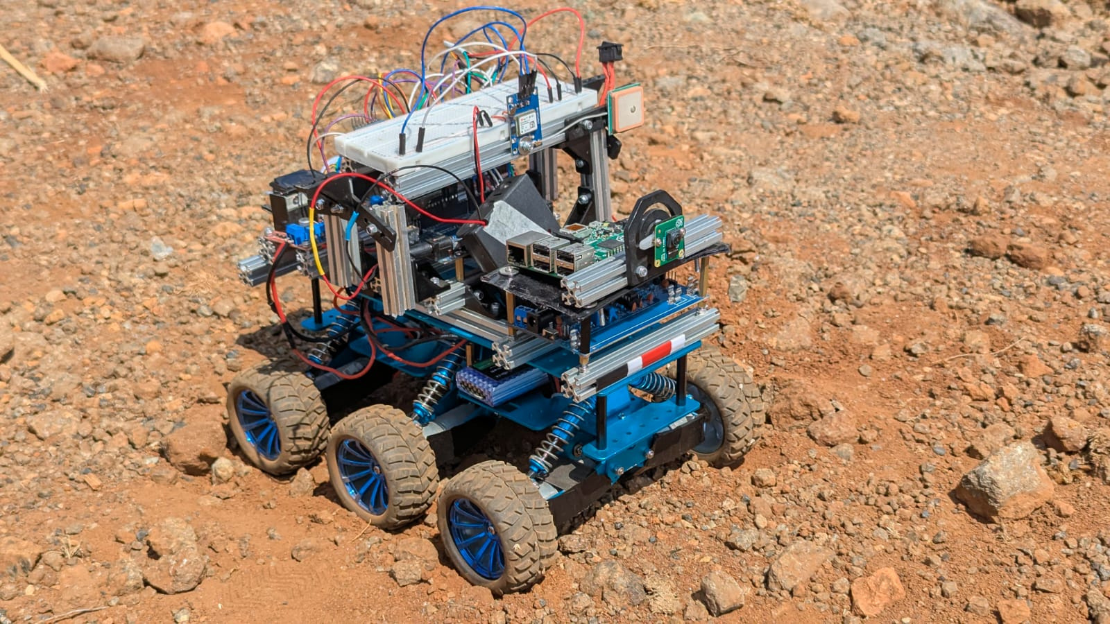 VERSION ONE / WORKING PROTOTYPE
02 / THE RANGER PLATFORM
Explore how RANGER brings field observations into focus. This interactive preview uses example data.
03 / DEVELOPMENT STATUS
Field maps, sensor records, camera views and remote controls bring observations and operator awareness into one place.
We are exploring easier survey planning, clearer reporting and tools to help teams follow changes across their sites.
Field testing will help us understand how reliably RANGER can move, gather observations and support repeatable surveys. Pilot readiness will depend on those results.
APPLICATIONS IN DEVELOPMENT
RANGER’s modular approach is intended to support these uses as payloads, navigation and field performance are validated.
Planned soil-moisture sensing and crop observation could help teams investigate variation across a field and target closer inspection.
The goal: support irrigation and land-management decisions with measurements tied to a location.
Explore remote inspection and radiological surveys where reducing human exposure is valuable.
Payload selection, safe operating limits and site-specific validation would determine which environments RANGER can enter.
Develop site surveys for air quality, radiation, soil moisture and water-quality investigation using appropriate sensing or sampling arrangements.
Connect local observations with geospatial context and satellite data to investigate environmental change.
A development direction for depth sensing and geospatial mapping is the creation of 3D site records, with potential uses in property tours and environmental digital twins.
Mapping accuracy, coverage and indoor navigation remain to be established.
BUILD WITH BYTEANZA
Research partnerships, sensor integration and prospective pilot programmes.